“Maps are the memories we have not yet earned. A solicitation and a goad to get us out in the territory and on the move, challenging or approving the fictions of the map-makers.’ – Iain Sinclair
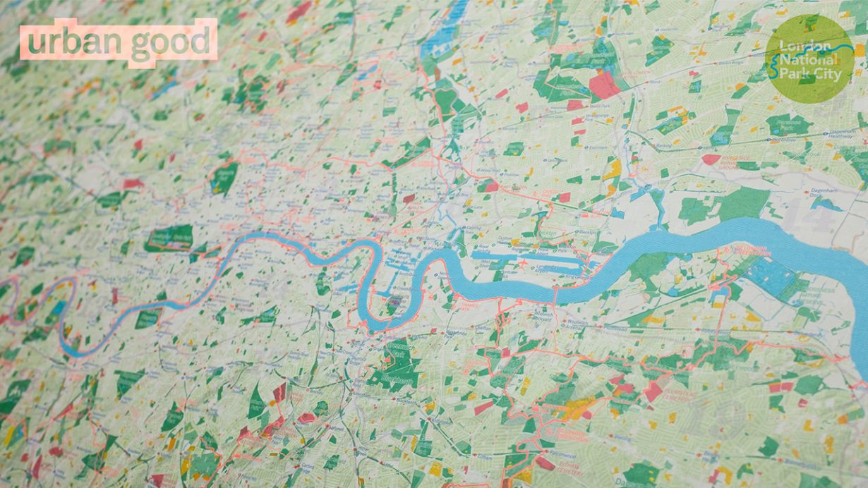
Check out this map by Urban Good showing London as the world’s first National Park City. The massive map includes all of the capital’s 3,000 parks plus woodlands, playing fields, nature reserves, city farms, rivers, canals and all the spaces that contribute to London’s parkland. Some of the most iconic walks through and around London are drawn, such as the London Loop and Capital Ring, along with symbols marking places to swim outdoors, climb hills, pitch a tent or go kayaking. It even shows front and back gardens, but not any buildings!
The real power of this map lies in the imagination of every child and adult who sees it: to re-frame their city as a connected and natural landscape. It is a map to inspire going outdoors: especially getting people to try something new ‘“ like walking a new part of the city, swimming outdoors, or climbing a hill for a new view.
London being a National Park City is a vision which celebrates and recognises what’s already being done in the capital, but challenges Londoners to work together to make the capital even greener, healthier, more naturally diverse, resilient, beautiful and enjoyable. The charity is making plans with the Mayor of London and an alliance of councils, groups and organisations for the London National Park City to be declared in Spring 2018, and then launched the following year.
The map has been created by Charlie Peel, founder of Urban Good CIC. In collaboration with Ordnance Survey and Greenspace Information for Greater London CIC (GiGL). Unfolded the map measures 125cm x 95cm, the same as an OS Explorer map, but includes the whole of Greater London and extends beyond the M25. In doing so, it successfully reveals how London is not just a city, but a large and complex landscape too.
Londoners will find the map goes beyond the London A-Z to reveal the capital as you have never seen it before. We hope Londoners will use it to explore their local area and further afield, and enjoy London’s great outdoors! Printed on the rear of the map is an entire London National Park City Atlas on one page. There are twenty ideas for exploration and adventure, a London Rivers Atlas, infographics and information on how Londoners can help make the London National Park City a success.
Best of all, the map will be free to the public. Keep an eye on Twitter for news, or sign up to the London National Park City newsletter to stay up to date and find out where to get your copy in the future.
To enable thousands more maps to go to schools, Londoners and visitors, Urban Good are seeking funding partners to help cover print costs as well as start building a digital tool for exploring the National Park City.
Here’s how you can get involved:
- Sign up to the National Park City newsletter
- Follow @LondonNPC and @UrbanGoodCIC on Twitter


AH. Great post about London’s open spaces. A yea ago I was inspired by your micro adventures and we grabbed a map of our city (Boston, USA) and looked for all the green spaces. Each weekend we try to explore one. It’s been super relaxing to get out in nature within 20mins or so… who knew those open spaces were there and so close? Anyway it’s been fun and I really enjoy you blog; thank you for posting interesting things with great photos that keep me inspired to get outside.
Wow, so many parks in London! I live here and even I barely believe that numbers 😀